
Creating Guide Points
Guide points can be created from any category point data in the project and added to surfaces. Category data that can be used to create guide points includes:
- Downhole category point data
- LAS points
- Category data on imported points
- Interval midpoints
Guide points are classified into interior or exterior, and each guide point is assigned a distance value that is the distance to the nearest point on the opposite side. Interior values are positive and exterior values are negative.
Guide points are a good way of using blasthole data to control surfaces: create the guide points from the downhole points, then add the guide points to the surface.
To create guide points, right-click on the Points folder and select New Guide Points. A window will appear listing the category columns available in the project:
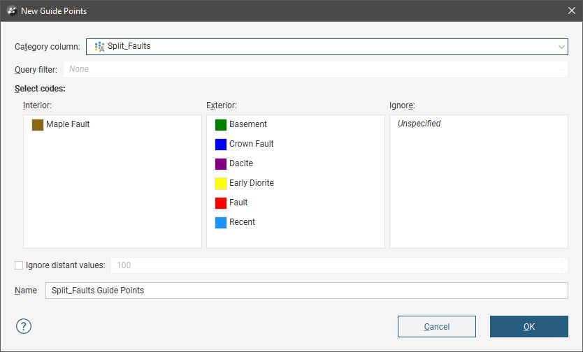
Select the categories to assign to Interior (the positive side) and Exterior (the negative side).
You can also filter out distant values by ticking the Ignore distant values box and entering a value. Often distant values have little effect on a surface and filtering out these values can improve processing time.
Click OK. The guide points will appear in the project tree under the Points folder. To edit the points, double-click on them.
Guide points can be exported as described in Exporting Points Data.
Got a question? Visit the Seequent forums or Seequent support
© 2023 Seequent, The Bentley Subsurface Company