Interpolant Functions
Leapfrog Geo’s powerful 3D interpolation engine can interpolate any numeric data (e.g. ore grade or piezometric head measurements) to describe how a real, numerical quantity varies in three dimensional space. Interpolation produces an estimate or “interpolated value” of a quantity that is not known at a point of interest but is known at other points.
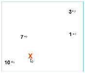
The simplest way to estimate values is to take the average of known values. Using this method, estimated values are the same everywhere, regardless of the distance from known data. However, this is not ideal as it is reasonable to assume that an estimated value will be more heavily influenced by nearby known values than by those that are further away. The estimates for unknown points when varying the distance from known point values is controlled by the interpolant function. Any interpolation function and the various parameters that can be set for each will produce a model that fits all the known values, but they will produce different estimates for the unknown points. It is important to select interpolation functions and parameters that make geologic sense. It may be necessary to identify a location that models predict differently, and plan drillholes to identify the best fit option.
Leapfrog Geo uses two main interpolant functions: the spheroidal interpolant function and the linear interpolant function. See The Spheroidal Interpolant Function and The Linear Interpolant Function for more information.
Got a question? Visit the My Leapfrog forums at https://forum.leapfrog3d.com/c/open-forum or technical support at http://www.leapfrog3d.com/contact/support
