What’s New in Leapfrog Geothermal 3.8
New features and enhancements in Leapfrog Geothermal version 3.8 are:
- High Resolution (4K) Monitor Support
- 2D Cross Sections for Geotechnical Analysis
- Polar Stereonet
- View Upload Progress and Notifications
- Well Trace Labels
- Polyline Editing Improvements
- Draped GIS Objects Organisation
High Resolution (4K) Monitor Support
Enjoy sharp clear 3D graphical display with support for high resolution and 4K monitors and laptops.
2D Cross Sections for Geotechnical Analysis
Now when you export a cross section evaluation from your Leapfrog Geothermal project, you have the option of flattening to 2D and specifying a new origin point.
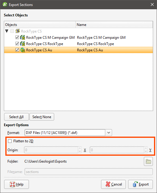
This translates the cross section from the 3D real world spatial location in Leapfrog Geothermal into a 2D drawing space.
Polar Stereonet
Polar stereonets are often used in geotechnical work to identify structural trends and are now available with either equal area (Schmidt) or equal angle (Wulff) projections.
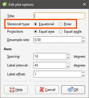
See Plot Options for more information.
View Upload Progress and Notifications
When uploading to View, it is now easy to see status of your uploads and receive notifications when they are complete.
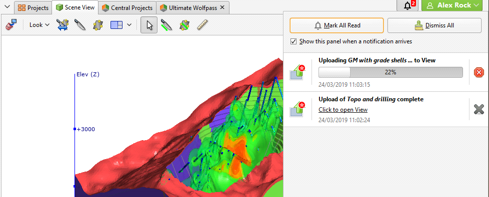
See Uploading to View for more information.
Well Trace Labels
You can now display hole ID labels for well traces. This is enabled in the shape list by clicking the text button (![]() ):
):
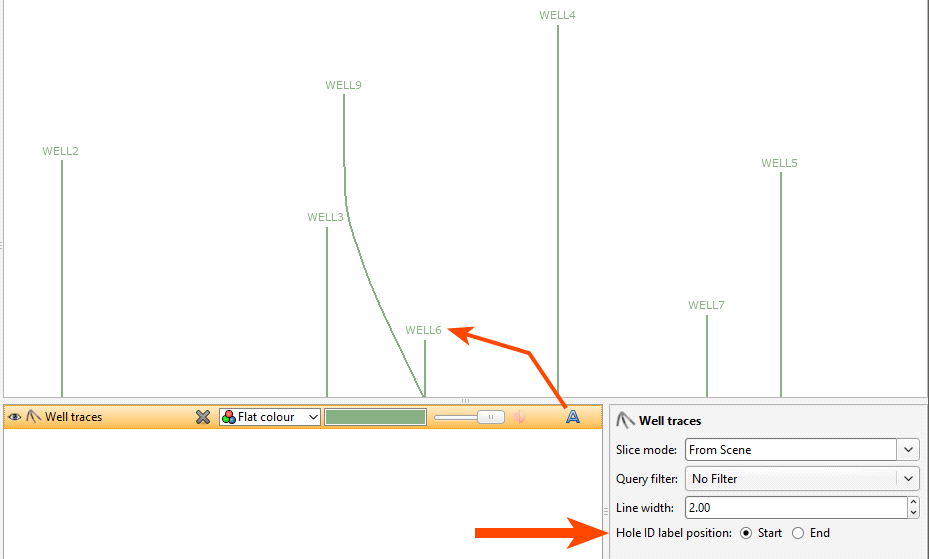
The label position is set in the properties panel; the label can be at the start of the trace or at the end of the trace.
Polyline Editing Improvements
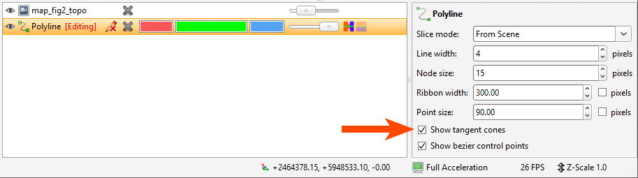
Small changes have been made to how polylines are displayed and edited. The first relates to polyline tangents, which sometimes obscure the polyline, making editing difficult. You can now hide polyline tangents by disabling the Show tangent cones option in the properties panel:
The second change is to default settings for polylines. Polylines can be displayed in two sizes: real-world size and pixels, and previously new and imported polylines would be displayed real-world size, with the ribbon size set to 50 and the point size set to 20. Two changes have been made to polyline display sizes:
- The default setting will be pixels instead of real-world size.
- The default ribbon size will be 20 pixels and the default point size will be 8 pixels.
This change does not affect existing polylines.
Draped GIS Objects Organisation
GIS objects draped on the topography have previously appeared in the Topography > Draped GIS Objects in order of drapage, which can make working with data objects difficult when a project contains a lot of GIS objects. The organisation of objects in the Draped GIS Objects folder now reflects that in the GIS Data, Maps and Photos folder:
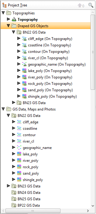
This includes batch imported ESRI and MapInfo data objects.
Empty folders in the GIS Data, Maps and Photos folder will not appear in the Draped GIS Objects folder.
Got a question? Visit the My Leapfrog forums at https://forum.leapfrog3d.com/c/open-forum or technical support at http://www.leapfrog3d.com/contact/support