
Pack a Map
To pack a map, select the map of interest and click the Map > Pack Files menu item, or right-click on the selected map in the Project Explorer, and select Pack Map Files (from the right-mouse button menu). The map and all of the associated files (i.e. grids, images, symbols, 3D Views, projection information) will be included in a single Geosoft *.map file.
You can use this option to archive a map with all of its component files or to send the packed map to colleagues. When you (or a colleague), unpacks the map file, all of the individual files (i.e., grids, images, symbols, 3D views, projection information, etc.) will be available in the current project.
Use the Pack and Send To option to quickly pack and send maps to your colleagues using Oasis montaj.
How to Pack a Map
-
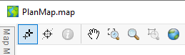
Select the map that you want to pack from the Maps list in the Project Explorer.
-
On the Map menu select Pack Files, or from the right mouse button menu in the Project Explorer, select Pack Map Files.
-
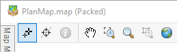
The map is packed, and the map files are placed in the packed map file.
A packed map will appear with a new icon in the window title bar and a suffix "(Packed)" will be displayed after the map file name – to indicate that this is now a packed map.
The PACKALLMAPS GX can be used to pack all maps currently open in a project.
See Also:
Got a question? Visit the Seequent forums or Seequent support
© 2023 Seequent, The Bentley Subsurface Company
Privacy | Terms of Use