Raster Appearance Tools
Summary
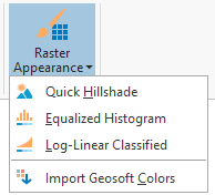
Target for ArcGIS Pro provides three raster appearance tools that apply a specific, customized symbology to a selected raster layer, as well as the ability to import Geosoft color ramps to ArcGIS Pro. These are:
-
Quick Hillshade
-
Equalized Histogram
-
Log-Linear Classified

These tools are context sensitive: they are only visible if the currently select layer is a raster to which the symbology can be applied. For example, selecting a hillshade layer will cause these tools to disappear since these symbology types cannot be applied to a hillshade layer.
Quick Hillshade
Hillshades, or shaded relief images, are a common method used to present geophysical and other types of geoscience data. This presentation technique creates a 3-dimensional effect using 2-dimensional rendering or plotting capabilities. The result is useful for checking the quality of the data and for data interpretation.
The Quick Hillshade tool applies a multidirectional hillshade raster function to the currently selected raster layer. The tool calls the Hillshade Raster function with several of the options set to default values. For example, the hillshade type is set to multidimensional and the Z factor (which affects the height of the shadows) is automatically calculated to be optimal for the data range.
Equalized Histogram
This tool applies a histogram equalized color classification that is commonly used with geophysical raster datasets. In Geosoft Desktop software, histogram equalized is the default appearance for rasters. Histogram Equalization is a method for enhancing contrast and visible detail in a raster image.
The histogram equalization method divides the input data values into histogram classes (or bins) such that each bin contains approximately the same amount of values. This results in more discrete bins in the most frequently occurring ranges of the input data, which increases contrast within those areas, making the image easier to interpret.
Log-Linear Classified
This tool applies a log-linear color classification that is commonly used with geochemical raster datasets. This method works by first calculating the log of each data value in the raster, then applying a linear stretch to the log values. In datasets with a logarithmic distribution, such as geochemical data, this helps to identify anomalies from the background data.
Import Geosoft Colors
The tool imports Geosoft Color files into the current project Styles.Color schemes are stored as styles within a project.
Style files in ArcGIS Pro are project specific, so you will need to import Geosoft color schemes into each project in which you wish to use them. See Technical Notes bellow for more information on Esri and Geosoft color schemes.
Technical Notes
About Esri Color Schemes
A color scheme is a range of related colors that can be applied to a collection of features, rasters, layout graphics, or symbol components. Color schemes were previously known as color ramps.
Learn more about ArcGIS Pro Color Schemes
About Geosoft Color Files
Geosoft color schemes are often referred to as "color tables" and can be either continuous (TBL or LUT files) or discrete (ZON or ITR files).
Learn more about Geosoft color tables here:
Got a question? Visit Seequent Forums or Seequent Support