Thickness Grids
Exporting a mesh as a thickness grid is an option for some types of meshes in the Meshes folder. It is not, however, available for interpolated meshes, triangulated meshes or 2D interpolant meshes.
Formats Leapfrog Works can export are:
- ARC/Info ASCII Grid (*.asc)
- ESRI.hdr Labelled (*.bil)
- ENVI Raster Image (*.img)
- Surfer ASCII Grid (*.grd)
What is calculated for the thickness grid is not the true thickness but is the vertical thickness at each location. The process is as follows:
- Leapfrog Works generates a regular grid of points directly above the selected surfaces.
- The points are projected down onto the top surface, then onto the lower surface.
- The distance is calculated between the pairs of points and used to produce a thickness grid that sits at zero elevation with values representing the distance between points.
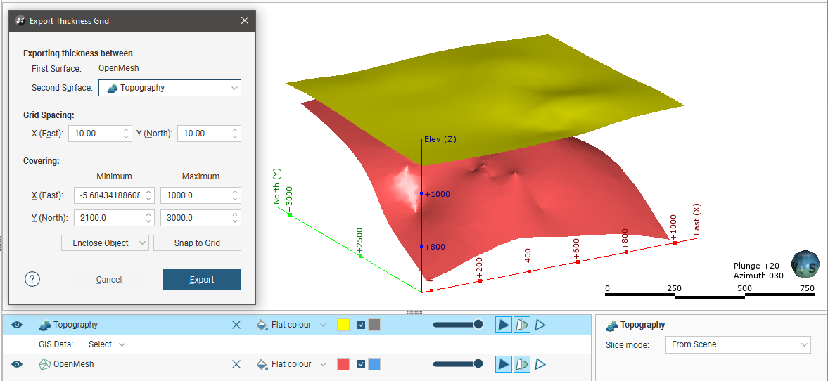
In this example, a thickness grid is exported for an open mesh and the topography:
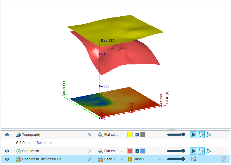
When the exported grid is imported back into Leapfrog Works, we can see that the values on the grid represent the vertical distance between the selected surfaces:
To export a thickness grid, right-click on the mesh and select Export Thickness Grid. The Export Thickness Grid window will appear:
Select a second surface and set the grid spacing and covering.
Click Export. You will be prompted to choose the file format and for a filename and location.
If you choose to export a thickness grid for a closed mesh, you will not be prompted to select a second surface; the points are projected from the upper surface of the volume onto the lower surface.
Got a question? Visit the Seequent forums or Seequent support
© 2022 Bentley Systems, Incorporated