Importing Data from an ESRI Geodatabase
You can import points, lines and polygons from an ESRI geodatabase. However, the import of raster data is not supported.
To import GIS points, lines and polygons in this way, right-click on the GIS Data, Maps and Photos folder and select Batch Import > from ESRI Geodatabase. In the window that appears, navigate to the folder that contains the database and click Open.
Leapfrog Works imports uncompressed ESRI geodatabases.
The data that can be imported will be displayed and you can select which files to import:
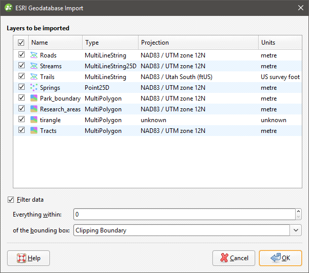
You can select multiple files using the Shift and Ctrl keys.
Data is automatically clipped to the clipping boundary, but you can change how the data is filtered to suit any bounding box that exists in the project. If you do not wish to clip the data, untick the Filter data box.
Click OK to import the selected files, which will be added to the GIS Data, Maps and Photos folder as a group (![]() ). Data in the group can be reloaded individually or as a group, which is described in Reloading GIS Data.
). Data in the group can be reloaded individually or as a group, which is described in Reloading GIS Data.
Got a question? Visit the Seequent forums or Seequent support