The Datasets tab of the Drillhole Datasets pane allows you to view the drillhole dataset(s) in the current project. If more than one drillhole dataset is present, they will each appear here as "geodatabase\feature dataset name".
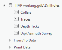
Click on Datasets in the Current Dataset section of the Target tab, to open the Drillhole Datasets pane. The Datasets tab under this pane, presents the contents of all imported drillhole datasets in an order that makes sense for viewing a drillhole project. The spatial location information about the drillholes is presented in this order:
Selecting a geodatabase\feature dataset will show the Drillhole Dataset Properties in the lower portion of the panel. This includes dataset-level information such as:
Pressing the More button will show a pop up dialog with detailed information about the import source data type and file location.
From the Datasets panel you can add any feature class, or attribute to the active map or scene:
Expanding a feature class will show the various attributes in each feature class, which can be used for symbology.
Adding data at the attribute level will automatically symbolize the layer based on the selected attribute.
|
Access MyGeosoft Support >> for online support and learning resources: Knowledge Base Articles, Guided Learning Path Lessons, Instructional Videos, Technical and Technology Papers, and Best Practices. |
|