
Desktop Dynamic Linking
Desktop Dynamic Linking enables you to visualize locations across multiple windows simultaneously — the system enables you to select a location on a map or in a database (spreadsheet or profile window) and highlight those geographic locations on (other) maps.
For example, when you open a map, the system automatically turns on a map link and activates the Shadow Cursor  button on the Map navigation toolbar.
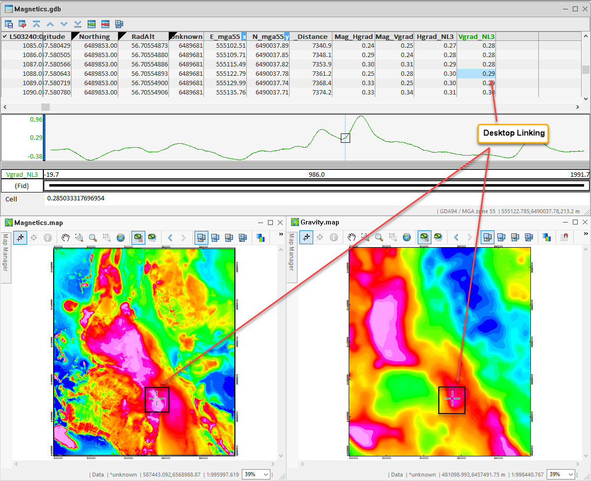
Use the Shadow Cursor button to create a dynamic link between one or more maps. When you select a location and place the "shadow cursor" on one map, the same geographic location will be highlighted in all the other map views.
This type of interactive graphical connection provides a great way of visualizing original or processed results in a view and seeing the corresponding representation in another view.
You can also link a data point in your database (in the Spreadsheet or Profile window) to all the associated maps. As you select data in a database, the geographic location is automatically highlighted with a "shadow cursor" in all maps.
You can display multiple maps and use this functionality to locate and visualize the same anomaly locations for different data types, for example using magnetic and electromagnetic maps together. The following example shows two linked maps: gravity and magnetics.
It is not necessary to have a database open to link maps.
See Also:
Got a question? Visit the Seequent forums or Seequent support
© 2023 Seequent, The Bentley Subsurface Company
Privacy | Terms of Use