
Define the Coordinate System of a Grid
When you create a grid from a database that already has location (coordinate) channels with a defined projection, the coordinate system information in the database is automatically applied to the grid. Therefore, to ensure consistency between your databases and grids, it is good practice to define a projection in your database before creating grids from it. For more information on defining the map projection for database channels, click here.
To assign a coordinate system, you must know the coordinate system that the data was collected in. If the wrong coordinate system is specified, the system may display the data incorrectly, in the wrong place, or take an usually long time to process. Usually with geographic data, the coordinate system and projection methods are known and provided with the data.
The Coordinate System tool allows you to specify the coordinate system, the length units, the datum, local datum transform and projection method for your data.
Define, Verify or Modify the Projection Information of a Grid
-
On the Grid and Image menu, select Properties. The Grid Properties dialog is displayed.
-
Using the Browse... button, specify the grid you would like to modify and click the Next> button to continue.
-
The Grid Properties dialog is displayed. Click the Modify button to continue.
-
The Modify Grid Properties dialog box is displayed. To modify (or define) the map projection of the grid file, click the CoordSys button.
-
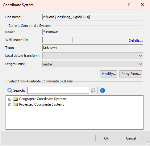
The Coordinate System dialog is displayed. The system displays the current projection information for the grid. The example below shows this grid with no projection information set.
Got a question? Visit the Seequent forums or Seequent support
© 2023 Seequent, The Bentley Subsurface Company
Privacy | Terms of Use