Surface Resolution in Leapfrog Geo
In Leapfrog Geo, meshes are used to represent surfaces in the form of vertices and triangles that define the 3D shape of the surface. The resolution of a surface is controlled by the size of the triangles used to create a surface. A lower surface resolution value means smaller triangles and, therefore, a finer resolution. A higher surface resolution value will take less time to process but the surface may not show the level of detail required.
When a surface is imported, Leapfrog Geo automatically sets a surface resolution based on the information in the file. It is not possible to change the resolution of surfaces imported into Leapfrog Geo. The exception is elevation grids (see Importing an Elevation Grid).
When surfaces are created, Leapfrog Geo sets a default resolution based on the data available. You can set a lower value, but calculations will take longer. In addition, the resolution for many surfaces can be adaptive; that is, areas closer to data will have a finer resolution than areas further away from data.
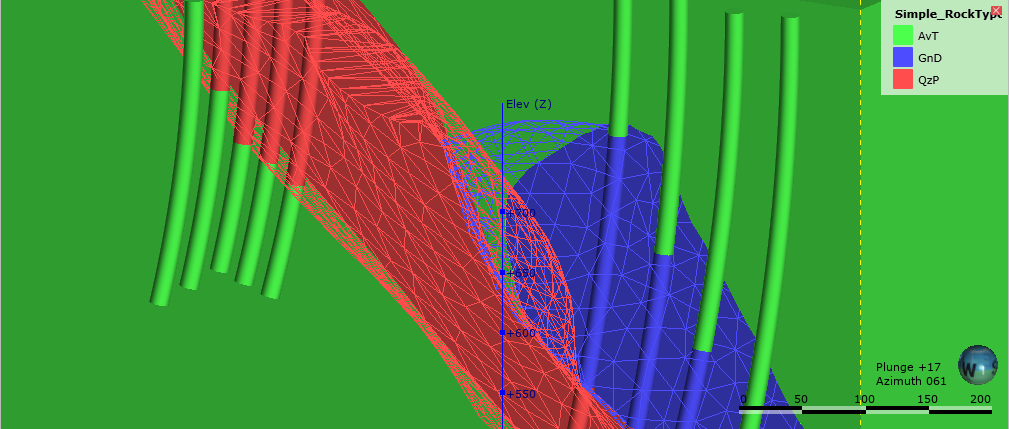
To see the effect of different resolution settings, consider a simple geological model of three rock types. Here, the surface resolution is set to 50 and the adaptive isosurfacer is disabled:
Here, the resolution has been reduced, which results in smaller triangles:
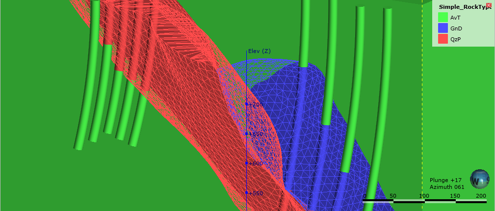
For both resolution settings above, the triangles are the same size everywhere in each surface, even where real data is available. Once the adaptive isosurfacer has been enabled, the triangles closer to the drillholes are smaller than those further away:
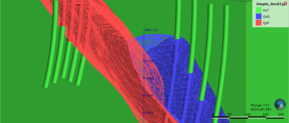
Areas of the surface that have large triangles indicate that there is less data in those areas to guide the interpolation of the surface.
In Leapfrog Geo, the resolution for different types of surfaces can be controlled as follows:
- For geological models, a resolution can be set for the model as a whole, but individual surfaces can have different settings. See Surface Resolution for a Geological Model.
- For interpolants, the resolution of the output isosurfaces is controlled by a single setting that can be overridden for individual surfaces.
- The resolution can be changed for editable interpolated meshes (
 ) and can be adaptive. See Interpolated Meshes.
 - When the topography has been defined using multiple data sources, the resolution can be set and the adaptive option is available. See Changing Topography Settings.
Got a question? Visit the Seequent forums or Seequent support