Add/Modify Data (1/3) - Data Source
This same tool is used to add data to VOXI the first time, and to subsequently modify it.
Use the Data > Add Data option on the VOXI Manager tree to add either a database, or a grid containing the observed data, for the modelling.
Subsequently, to modify the data of an existing VOXI document use Data > Data Source > Modify.
Data Source dialog options
|
Data source |
The data source can be provided in either Database or Grid format. Select the appropriate source. The type of data available to you in the next dialog depend on the selected data source. The gravity gradient data type is not supported by the Grid option in this dialog. | |
|
Database file |Sensor grid |
Depending on the above selection, you will be prompted to provide the appropriate file containing the observed values. If you chose the Database option, then you will be further prompted through the Channels group to define the 3D coordinates. If you chose the Grid option, you will be further prompted through the Sensor Elevation group to define the survey elevation datum. | |
Database File |
Grid File |
||
|---|---|---|---|
|
Channels group |
If you chose a database source, then you are prompted for the projected X,Y, and elevation channels. |
Sensor Elevation group |
If you chose a database source, then you are prompted for the elevation information. The projection is acquired from the grid. |
|
X Y |
If the coordinate channels are already defined, they will be displayed by default. You can select an alternate pair of x and y channels as long as they have a projected coordinate system defined. |
Elevation definition |
The elevation can be provided in 3 different ways. Constant elevation: indicates a constant barometric altitude. Provide this numeric value in the next entry. This value should be in the same vertical datum as the DEM. Constant above terrain: the value to add to the terrain to simulate an exact drape. The terrain is interpolated from the DEM to match the sensor grid. Elevation grid: the elevation grid must cover the measurement grid and be in the same vertical datum as the DEM. |
|
Elevation definition |
The elevation can be provided in two different ways. Sensor elevation: the vertical position provided is the elevation of the sensor. It should be on the same coordinate system as the projection datum. Terrain clearance: the vertical position provided is the terrain clearance. This is usually the radar altimeter. |
Elevation |
If Elevation definition is chosen as Constant elevation or Constant above terrain, then enter the positive value representing the selection. Otherwise, enter the grid name defining the elevation |
|
Sensor elevation
Above terrain |
The channel containing the elevation of the sensor.
The channel containing the terrain clearance of the sensor. |
||
|
Optimize data sampling |
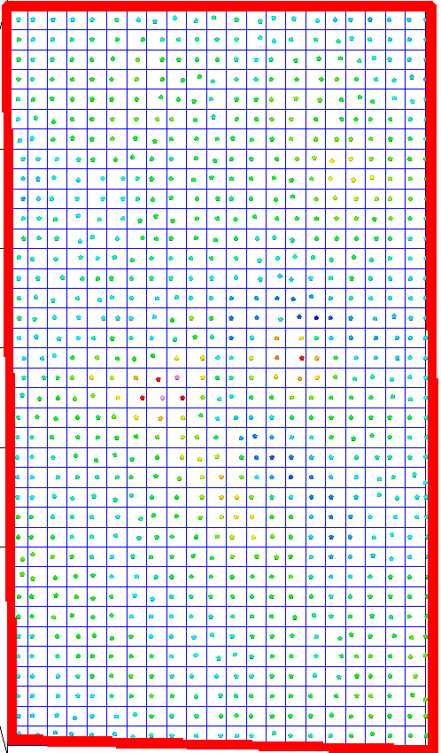
If relative to the size of the voxel model element, the data it is too highly sampled, sending all the observed data to the inversion adds no value, but slows down the process. You can decimate the data with little to no loss of precision and thus speed up the process. By default, the data will be decimated to yield roughly one sample per surface voxel element. (see Figure 1). |
|
|
Samples per cell |
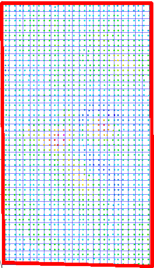
The number of samples per horizontal cell is customizable. Prior to modelling, all observations and their positions within the same horizontal cell are averaged to yield the required number of samples per cell (see Figure 2). |
|
Application Notes
|
|
|
||
|
Figure 1: One sample per cell |
Figure 2: Two samples per cell | ||
The data added to VOXI is provided in one of two ways:
-
As a Geosoft Database (.gdb) file: Within the database each observed value must have 3D coordinates (x, y, and elevation). The x and y channels must have a projected coordinate system defined. Although VOXI models the variation of the geophysical property of the model rather than the absolute property, the observed data can be supplied as absolute or residual. There is an option within VOXI to remove the background on the fly.
-
As a Geosoft Grid (.grd) file: this grid must be supplied along with an elevation grid. These two grids are converted into a Geosoft database and added to the VOXI document.
Once you have specified the data, click Next to proceed to the Measurements dialog box. Use the Measurements dialog box to define the data type and measurement fields in your database.
The constant elevation is deliberately not offered when working with an input database, because the elevation information always exists as a channel in the database.
Access Seequent Online Learning and select the VOXI guided paths to learn more about effective workflows and key concepts.
Got a question? Visit the Seequent forums or Seequent support
© 2023 Seequent, The Bentley Subsurface Company
Privacy | Terms of Use


