
Project Explorer
The Project Explorer, found below the Oasis montaj menus, is the window into the data files contained within the currently open project.
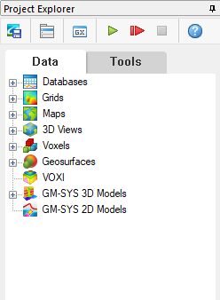
All of the data files that you have created or opened in this project will be visible in the Project Explorer and grouped by data type (e.g., databases, grids, maps, 3D Views, voxels, geosurfaces, etc.):
You can open existing data files, create new files, and remove files from within the Project Explorer. You can also view the properties of most data files and access their metadata.
The Project Explorer window:
-
can be docked to the left side or to the right side of the project's workspace.
-
can be floating inside or outside the project's workspace.
-
can be "pinned" = open, or "unpinned" = displayed as a tab at the docking location.
-
cannot be closed.
The Project Explorer Toolbar
In your Oasis montaj project, you are able to access quick commands and functions within the Project Explorer. The toolbar provides access to some commonly used tools, such as:
|
|
Save Project Use this command to save the changes made to the project. |
|
|
Use this command to load/unload a menu to/from the menu bar. |
|
|
Use this command to run a GX from the \gx directory. |
|
|
Use this command to run a script with multiple parameters. You can also access the script for editing. |
|
|
Record Script Use this command to record a script to a new script file. If the script file (*.gs) already exists, you will be prompted to overwrite or append to it. |
|
|
Stop Recording Use this command to end recording the script. |
Project Explorer Tabs
The Data tab includes all the datasets opened or created in the current project.
Various tools to keep track of your project are available including the data description tool that enables you to add descriptive text to the data items listed in the Project Explorer. Enhanced metadata capabilities provide access to the properties of all data items displayed in the Project Explorer.
You can perform group actions like opening, removing, and creating multiple datasets by right-clicking the main folder items in the Project Explorer.
Individual datasets can be removed from the project or even permanently deleted from the system along with all auxiliary files. Individual datasets can also be renamed; this will also rename any auxiliary files at the same time. To access these features, mouse over the desired item in the respective folder, and use the right-context menu options.
What data tools are available?
Click on the links below to see the tools available for some of the commonly used data types:
-
 Project Explorer - Databases
-
 Project Explorer - Grids
-
 Project Explorer - Maps
-
 Project Explorer - Voxels
The Tools tab allows you to keep track of any Geostats/Geochemistry tools that may be used in your project, including the Histogram, Scatter Plot, Probability Plot, and the Triplot tools. You can show/hide the tools as needed, so that you can keep your project as streamlined as possible.
The Geostats/Geochemistry tools are available with a Geochemistry subscription of Oasis montaj.
Got a question? Visit the Seequent forums or Seequent support
© 2023 Seequent, The Bentley Subsurface Company
Privacy | Terms of Use