
Seeker
The Seeker tool was designed to help you search for and find relevant exploration data, and to download spatial data stored on global and corporate spatial servers: Geosoft DAP servers and WMS (Web Map Server) image servers.
To access the tool, select Seeker from the Data Services menu.
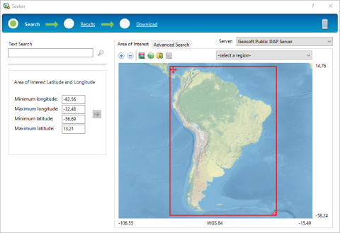
Your Search results will be displayed in lists or folders. Selected datasets appear in a thumbnail preview or geographically located on a preview map. Metadata can be used for searching or can be viewed for each dataset. Checking data on the Results page will display it in the Preview map area and add it to your Download list. Downloaded data is displayed in your current open map or displayed in a new data window, as applicable.
How to Use the Seeker Tool
Seeker will behave differently depending on whether you have an open map in your project.
With an Open Map:
-
If you have a map (with a defined geographic or projected coordinate system) active in your project, then the Search page will use the map to set your Area of Interest (AOI). Seeker will display only the data that matches the data view extents of your current map. You can use the navigation tools to modify the AOI or set it back to the current map extents.
-
If the area of interest that you are using intersects with the open map, and the dataset you have selected is completely within your AOI, then the entire dataset will be downloaded and displayed in the open map. Otherwise, the dataset is windowed using the extents defined by your AOI.
-
If the area of interest has been re-defined and does not intersect with the open map extents, the downloaded datasets cannot be displayed in the open map and will be displayed in a new window.
Without an Open Map:
-
If the dataset to be downloaded is completely within your area of interest, the entire dataset will be downloaded and displayed. The dataset extent is used to create the new window.
-
If the dataset to be downloaded overlaps with your area of interest, the dataset will be windowed to the extent of your AOI and displayed in a new window. The AOI extent will be used to create the new map. The downloaded dataset will be saved in its original coordinate system.
Related Topics
Got a question? Visit the Seequent forums or Seequent support
© 2023 Seequent, The Bentley Subsurface Company
Privacy | Terms of Use